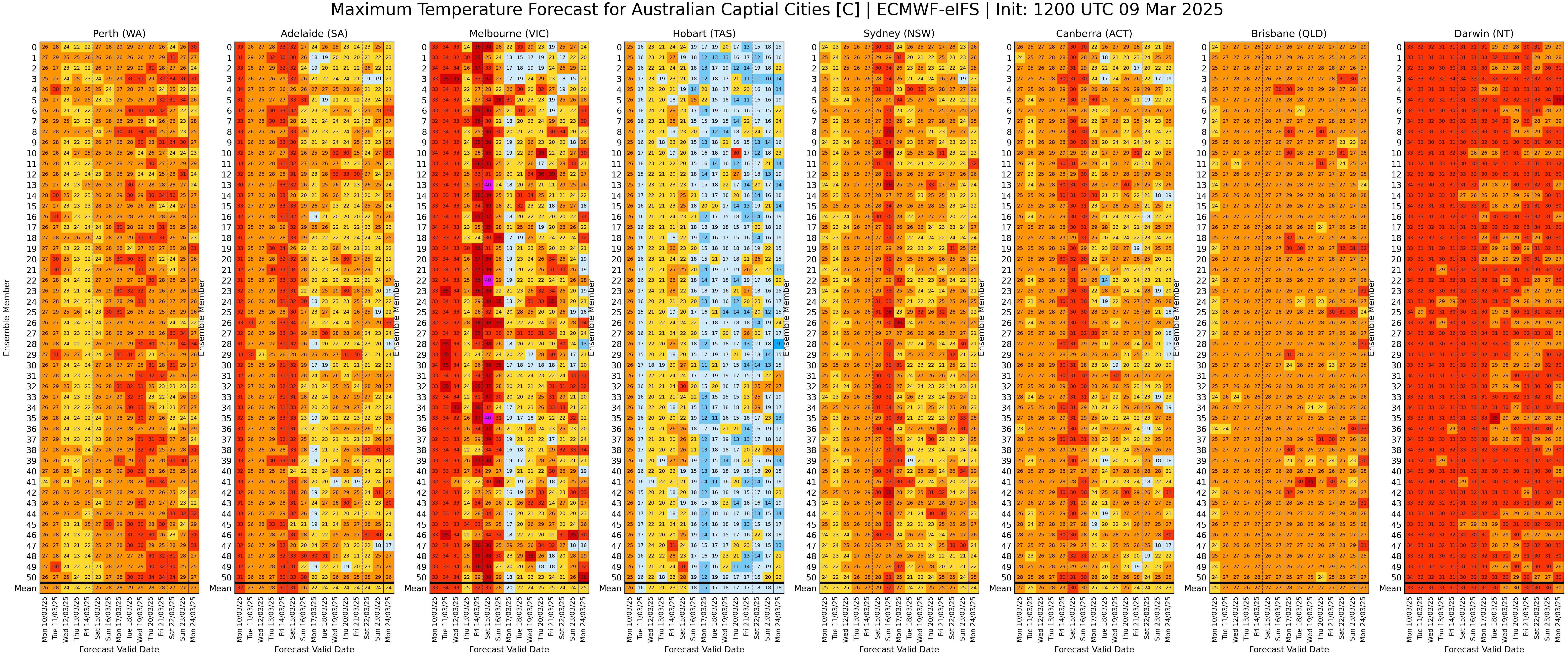
Hot and dry week for most of post-Alfred Australia
Weakened Alfred
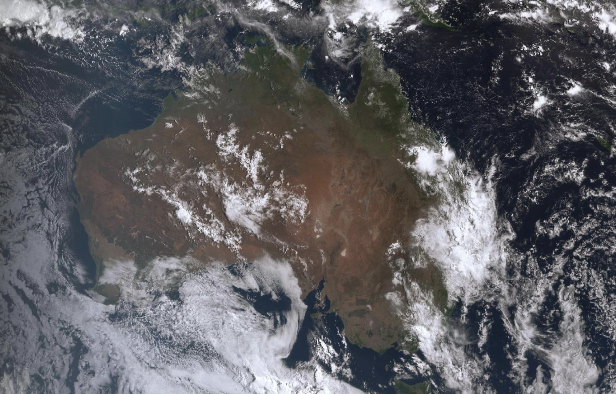
Tropical Cyclone Alfred, which impacted the east of the continent over the weekend, promised much but thankfully under-delivered. With the approach of Alfred, some significant coastal impacts were felt, particularly in the Gold Coast where surfers paradise beach was turned into a sandy cliff face by strong wind and wave action. As Alfred weakened and turned north early on Saturday morning, wind and storm surge related impacts were also relatively limited, largely sparing the populated city of Brisbane. Despite this, Alfred was responsible for damage across southeast Queensland, including downed trees and extensive power outages.
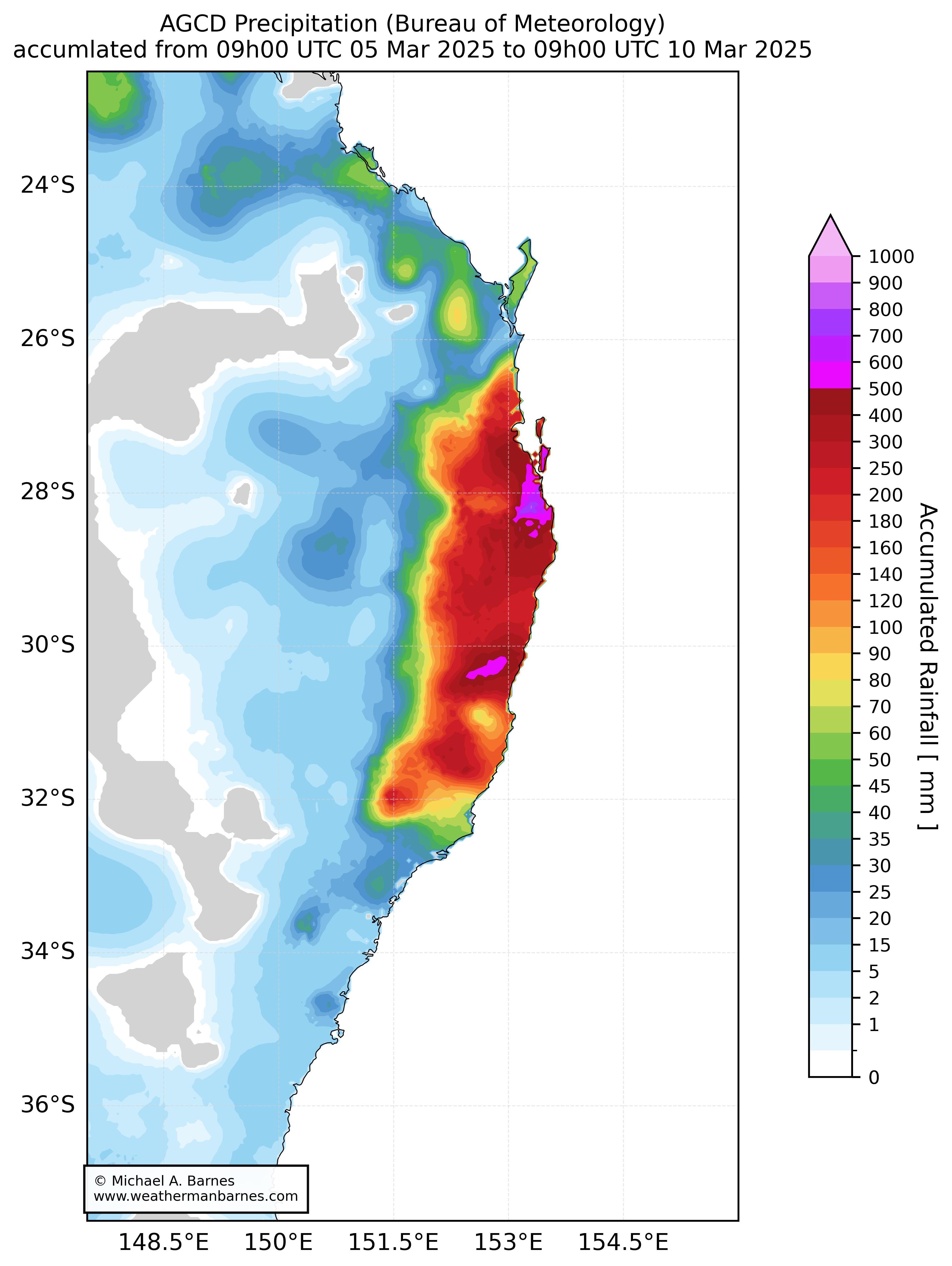
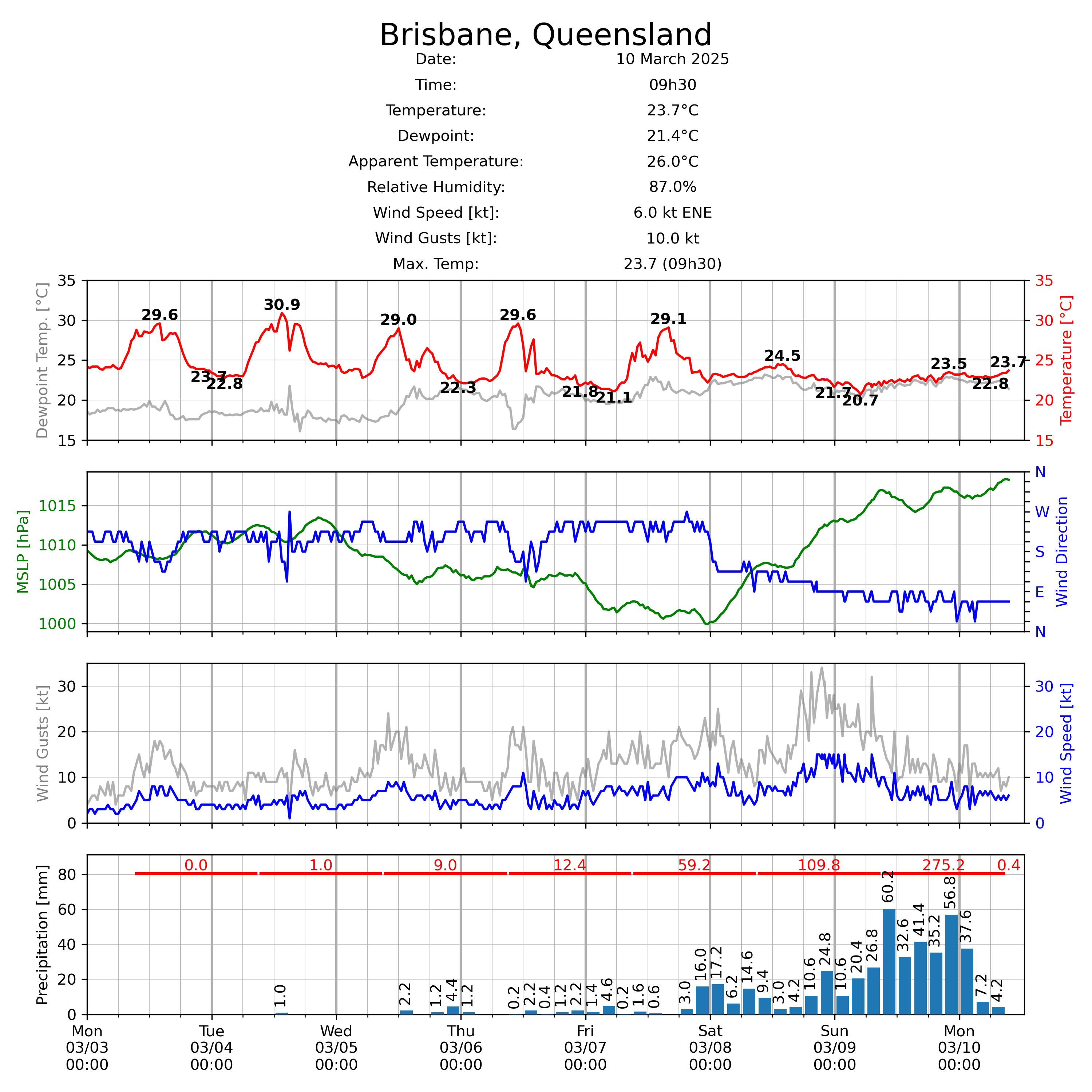
As with several other recent, comparatively weak tropical cyclones or depressions over the Queensland coast in recent years, rainfall has produced some of the most significant impacts. Heavy falls were experienced over northern NSW and southern Queensland both on approach and after landfall, with flooding affecting several towns in the region. Rainfall accumulations reached up to a metre at some locations. Extensive flooding has been experienced across the region, turning roads into rivers and towns into marshland.
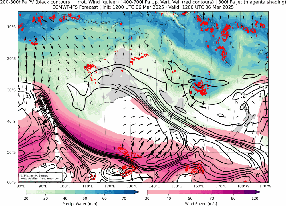
Rainfall resulted from the almost imperceivable remnants of Alfred which slowly progressed westwards throughout the weekend. A cut-off generated over South Australia late last week likely contributed to this rainfall, presumably helping to maintain and slow the vortex and provide some additional mid-level lift. Despite the presence of ex-Tropical Cyclone Alfred, the large-scale synoptic dynamics are not dissimilar to the well-known patterns of heavy rainfall over the region: low-level, moist easterlies together with upper-level forcing from the extratropics.
Hot and dry for most of Australia
Forecast models indicate relatively weak gradients across the continent throughout the week with hot conditions for much of Australia throughout this week. The Bureau has in fact forecast heatwaves for some parts of the central and southeastern parts of the country. The exception is the east coast, which, still under the influence of easterlies, will remain relatively cloudy, mild and showery.
Heat troughs are the feature for west throughout the week. Their interaction with upper-level Rossby waves (good, old fashioned, baroclinic instability) could result in a couple of cut-off lows spinning up and moving off of the south coast and towards Tasmania. If they occur, their associated frontal zones will give some intermittent relief to some parts of the south coast and Tasmania with milder periods and a few drops of rain.
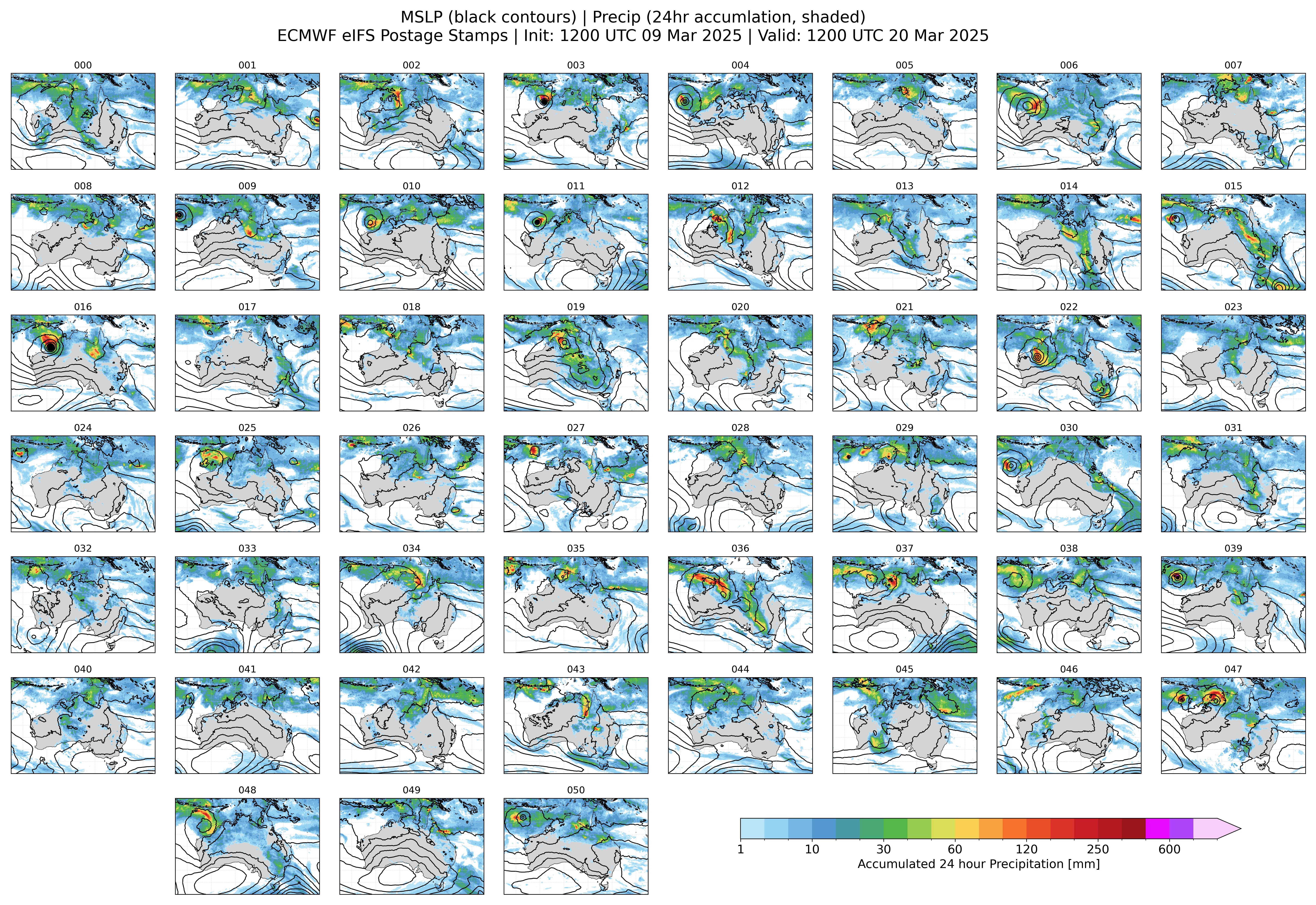
A mid-March burst in the tropics?
Latest forecasts from ensemble prediction systems tend to suggest that tropical Australia will become more active by mid-month with a late surge in monsoon activity. Although over 10 days out, there is a degree of consistency between members that the tropics will become more rainy along with a monsoon trough and westerlies over the continent. Despite models generally being over excited when it comes to tropical cyclone development on the medium-term timescale, there are also some signals for chances for development to the north or north-west of the continent.