Tropical Cyclone Alfred
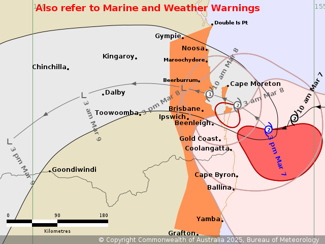
The attention of the weather world has been consumed by Tropical Cyclone Alfred this week. Alfred is expected to make landfall north of Brisbane on Saturday, 8 March 2025. Impacts have already been felt across southeastern Queensland and northeastern New South Wales, with heavy rainfall and large waves affecting the coastlineå
Atypical track and landfall
A landfalling Tropical Cyclone as far south as Brisbane is rare but is not unprecendented, with landfalls in the 1950s and 1970s over a similar area. Tropical Cyclone Zoe crossed the coastline further south than Alfred, landfalling over Coolangatta in 1974 and heavily impacted Brisbane and its surrounds, while Tropical Cyclone Daisy landfalled at the bar at Sandy Cape in 1972.
Tropical Cyclones often move as far south as Brisbane but few make landfall. This is because the systems that do make it as far poleward as this are often swept up by extratropical mid-level troughs over the ocean to the east of the continent. Their associated north-westerly flow move the tropical vortices southeastwards into the south Pacific and Southern Ocean. During this process, they typically transition into extratropical cyclones, developing a cold core, frontal zone and other typical extratropical cyclone characteristics.
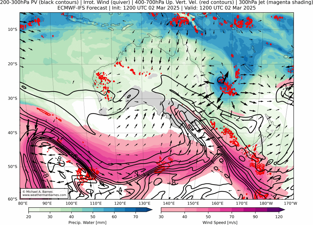
The relatively unique aspect of Alfred has been its handbreak turn to the west. This in itself is not unprecedented with Tropical Cyclone Dora having a very similar trajectory in 1971. The answer to its unusual track lies in the extratropics. As the Tropical Cyclone met up with its extratropical counterpart (shown below by the PV streamer in black contours), the extratropical wave broke and deposited an upper-level cyclonic PV cut-off (or cyclonic vortex) into the path of Alfred. This meant that Alfred was not met with strong northwesterly flow but instead found itself in stagnant flow with the weak cut-off above. Typically, the wind shear introduced by teh extratropical flow would have ripped this Tropical Cyclone apart. However, the weakness of the cut-off allowed for Alfred to dominate and "consume" the extratropical vortex and remain almost unaffected (although the northern quadrant to Afred was temporarily sheared off). Having survived the vertical wind shear of the extratropical flow, Alfred found itself in weak easterlies associated with the extratropical ridge that followed the trough which allowed it to drift slowly towards the Queensland coastline.
Prolonged, high impact
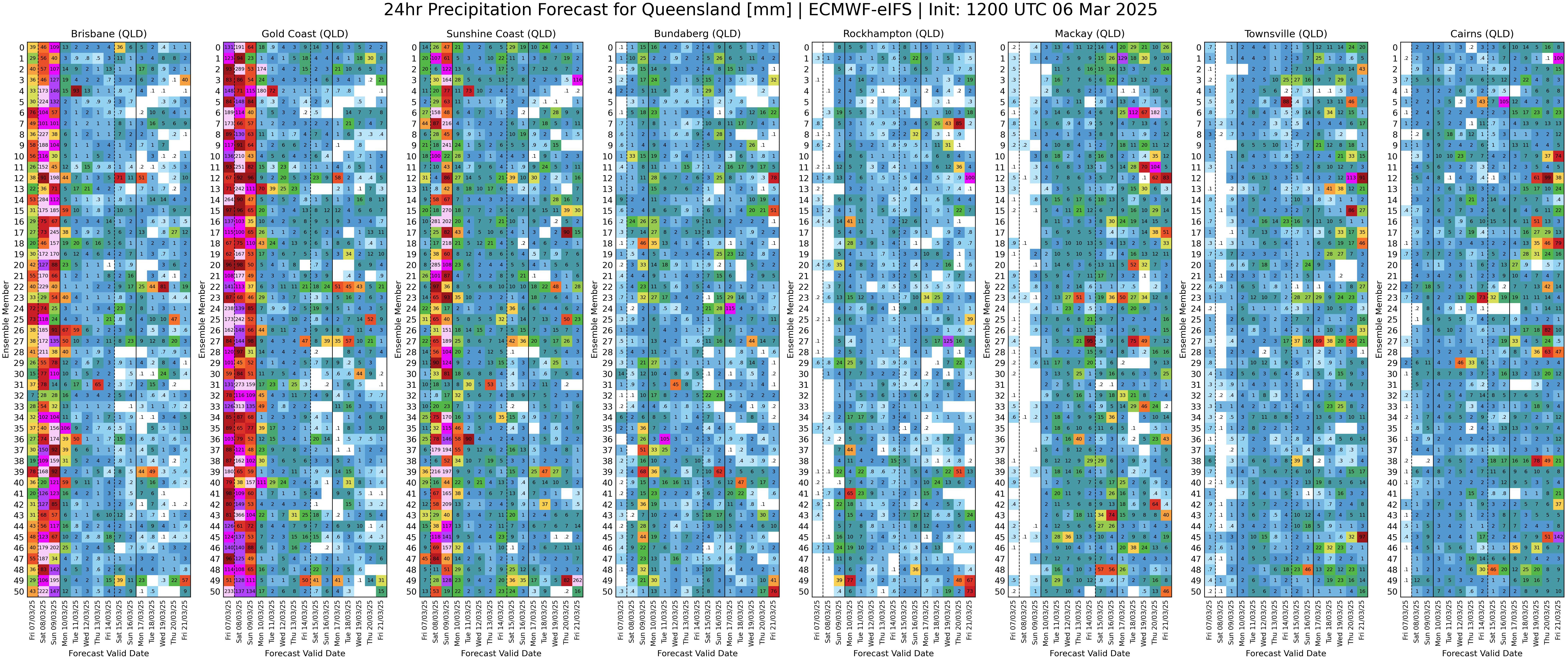
Alfred's propagation speed has been exceptionally slow, with current forecast putting its landfall north of Brisbane between 10h00 and 14h00 on Saturday, 8 March 2025. The result will be a prlonged, 48 hour period of heavy rain, extreme wind, high seas and storm surge - depending on where you are relative to the cyclone. Rainfall forecasts from ECMWF ensemble forecast system indicate possible accumulations of several hundreds of millimetres over both southeastern Queensland and northern New South Wales throughout Friday and the weekend. The remnants of Alfred will make its way through the interior of New South Wales, potentially exiting the New South Wales coast as far south as Sydney, with the potential for heavy falls along the northern and central coastal areas into Monday and Tuesday.